The Water of Leith Walkway - Dean Village to the Shore
A river path through the middle of a capital city that most visitors never find.
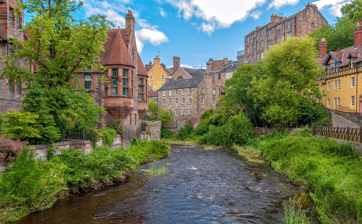
The Water of Leith runs from the Pentland Hills to the Firth of Forth, and its central walkway threads through some of Edinburgh's most layered ground. This guide follows the river from Dean Village downstream to the Shore at Leith, naming what survives and what to notice.
Dean Village
Dean Village sits in a steep valley west of the city centre, where the river once powered grain mills. The settlement grew around milling, and its name reflects that industrial past rather than a grand estate. Much of the old village was cleared or rebuilt, yet the street pattern, bridges, and river walls still show how tightly housing and water power were linked. Look at the carved stone, mill lades, and the way buildings step down to the water. The surviving fabric is modest but telling: it records a working riverside community rather than a planned showpiece.
The village also rewards attention to small details. Notice the weirs, the sluice channels, and the worn stone where water once turned wheels. These fragments explain why a dense settlement grew in a narrow gorge at all. Milling demanded fast water and steep drops, and Dean Village provided both.
The Dean Bridge
The Dean Bridge carries traffic high above the valley on a tall stone viaduct designed by Thomas Telford and completed in 1831. It is best understood from below, where its arches span the gorge and frame the river. From the walkway, the bridge reads as engineering made to shrink distance and flatten a difficult route into the city. Study the masonry, the height of the piers, and the contrast between the heavy structure overhead and the narrow water below. The bridge is not merely a crossing; it reshaped how Edinburgh moved west.
Telford's design used tall, slender piers to carry a road high above the river without blocking the valley. Walking beneath it, you can see how the structure solved a topographic problem: the gorge had long divided the city, and the bridge turned an obstacle into a route.
St Bernard's Well
St Bernard's Well is an eighteenth-century mineral spring site on the riverbank near Stockbridge. Its pump room and classical temple-like shelter belong to the era when spa culture made health fashionable. The well survived as a curiosity and a landmark, and its architecture is more visible than the water itself. Pause for the circular building, the columns, and the way the site turns a mineral source into a small civic monument. The river path passes close enough to let you read the structure as part of Edinburgh's medical and social history.
The well's name and classical styling reflect eighteenth-century tastes, when mineral waters were promoted for health. Today the building functions more as a riverside ornament than a working spa, but it still marks how Edinburgh's elites once treated the riverbank as a place for leisure and remedy.
Stockbridge
Stockbridge is the stretch where the walkway feels most like a neighbourhood. The old village grew around a bridge over the Water of Leith, and the name still marks that crossing. Today it mixes tenement housing, independent shops, and easy river access. What survives is less a single monument than a lived-in pattern: bridges, steps, riverside paths, and the habit of walking. Look at the water levels, the stone banks, and the way people use the path. Stockbridge rewards slow observation because its character is in daily use rather than in one famous facade.
The Stockbridge market and the surrounding tenements show how the river shaped settlement density. Housing climbed the banks, leaving the water edge for paths and bridges. This pattern, repeated along the valley, is one of the walkway's quiet lessons.
Scottish National Gallery of Modern Art
The Scottish National Gallery of Modern Art sits beside the Water of Leith, with its grounds meeting the river. The setting matters: modern sculpture and landscape are placed within walking distance of the city centre, yet close to the water's edge. What to look at includes the relationship between buildings, lawns, and riverbank, not only the collection indoors. The walkway gives a useful approach, letting the gallery appear as part of a wider riverside sequence rather than an isolated stop. Treat it as a place where art, landscape, and urban geography overlap.
The gallery's riverside position means visitors arrive on foot through green space rather than by road alone. Sculpture placed outdoors gains a different reading when seen against water, trees, and the changing light of the valley.
The Shore at Leith
The Shore at Leith marks the river's arrival at the historic port. Here the Water of Leith widens into a maritime setting of quays, warehouses, and converted buildings. The area carries layers of trade, shipbuilding, and harbour life, though much of the working waterfront has changed. What survives is the street line, the water edge, and the sense of a port town that became part of Edinburgh. Look at the reflections in the water, the old stone fronts, and the way the river finally opens out. It is a fitting end point because the walk moves from mill village to sea.
Leith's harbour history shaped Edinburgh's economy for centuries. Even where warehouses have become flats and restaurants, the quay line and the water's width keep the maritime memory legible.
Practical tips for the walk
Wear shoes with grip: riverside stone can be wet and uneven, especially near Dean Village and Stockbridge. Allow time to stop: the best details are found by pausing at bridges, weirs, and viewing points. Start early or late in the day: softer light helps with photographs and with reading building details. Carry water and a light layer: the valley can be cooler and breezier than the streets above. Check the path ahead: occasional closures or narrow sections may require a short detour. Respect residents: parts of the route pass through lived-in neighbourhoods with private access.
Frequently asked questions
Is the central walkway suitable for a casual walk?
Yes, the central stretch is generally manageable for ordinary walkers who are comfortable with uneven riverside paths, steps, and occasional narrow sections. Surfaces and gradients vary, so good shoes help. The route rewards patience more than speed.
What should I notice first in Dean Village?
Start with the relationship between the river and the buildings. The mill history is written into walls, bridges, and the steep valley, so the first useful habit is looking down at the water and up at how the settlement sits above it.
Why does the Shore at Leith feel different from the rest of the walk?
The river opens into a harbour setting, so the scale, light, and building types change. Earlier sections feel enclosed and green; the Shore feels maritime, with quays and a wider water surface marking the end of the inland walk.
This is an independent member's guide compiled by Edinburgh Society. We are not affiliated with the venues and institutions mentioned; opening arrangements and programmes change - always confirm details on the official websites before making plans.
← Back to Events